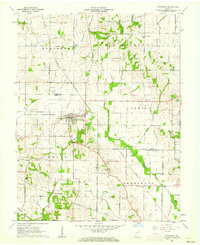
1961 Map of Cynthiana
USGS Topo · Published 1962About this map
Cynthiana sits at the nexus of several townships and counties in southwestern Indiana, anchored by its proximity to both the Chicago and Eastern Illinois and New York Central railroads. The 1961 landscape is defined by its agricultural and early industrial infrastructure, where oil wells dot the terrain alongside a network of rural churches and cemeteries. Settlements like Nisbet and community hubs such as the Township Sch and local Athletic Field reflect the social fabric of the era.
Find a feature on this map
37 named features on this map. Tap any name to fly to it.
Don’t see what you’re looking for? This feature index may not catch every label — zoom into the map to look around manually.
Map Details
Editions of this 1961 Cynthiana Map
Other maps of this area

1901 · Princeton
USGS Topo · 1:62,500

1901 · Haubstadt
USGS Topo · 1:62,500

1903 · Haubstadt
USGS Topo · 1:62,500

1903 · New Harmony
USGS Topo · 1:62,500

1903 · Princeton
USGS Topo · 1:62,500

1903 · Patoka
USGS Topo · 1:125,000

1904 · Mount Carmel
USGS Topo · 1:62,500

1938 · New Harmony
USGS Topo · 1:62,500

1956 · Vincennes
USGS Topo · 1:250,000

1957 · Vincennes
USGS Topo · 1:250,000