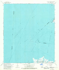
1968 Map of Cypremort Point
USGS Topo · Published 1970About this map
Cypremort Point serves as the primary coastal outpost on this late 1960s survey of the Louisiana Gulf Coast. The landscape is defined by the expansive waters of Vermilion Bay and West Cote Blanche Bay, separated by a complex network of reefs and islands. To the south, the northern edge of the Russell Sage Foundation Marsh Island State Wildlife Refuge is depicted, where Lucien Bayou and Bird Island Bayou cut through the marshy terrain. The presence of an Oil and Gas Field and a prominent Radio Tower reflect the mid-century industrial expansion into these coastal waters. Coastal navigators and researchers can identify local landmarks such as Shark Island, Blue Point, and the Terrapin Reef, which dictate the hydrography of this ecologically significant transition zone.
Find a feature on this map
19 named features on this map. Tap any name to fly to it.
Don’t see what you’re looking for? This feature index may not catch every label — zoom into the map to look around manually.
Map Details
Editions of this 1968 Cypremort Point Map
2 editions found
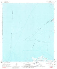
Other maps of this area

1932 · Bayou Blanc
USGS Topo · 1:31,680

1932 · Abbeville SE
USGS Topo · 1:31,680

1937 · Derouen
USGS Topo · 1:62,500

1945 · New Orleans
USGS Topo · 1:250,000

1946 · Redfish Point NE
USGS Topo · 1:31,680

1946 · Redfish Point SE
USGS Topo · 1:31,680
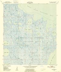
1948 · Bayou Blanc
USGS Topo · 1:24,000

1948 · Cypremort Point
USGS Topo · 1:24,000

1949 · Cypremort Pt
USGS Topo · 1:31,680

1949 · Bayou Lucien
USGS Topo · 1:31,680