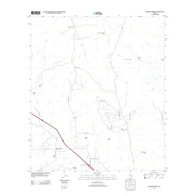
2012 Map of Cypress Creek
USGS Topo · Published 2012About this map
The watershed of Cypress Creek defines this area of the Texas Hill Country, where a network of large private ranches and rugged upland terrain has shaped the rural settlement pattern. Prominent ranching properties like Hillingdon Ranch, Turkey Hollow Ranch, and Hasenwinkel Ranch occupy significant portions of the landscape, often situated near vital water sources such as Bear Creek Spring and Dipping Vat Spring. This reliance on natural springs is a hallmark of the region's agricultural history, supporting both livestock and the small residential pockets found in Elm Valley and Apple Valley. Elevated landmarks including Rattlesnake Mtn, Broad Mtn, and Pointed Mtn provide topographic relief against the creek beds and winding local roads like Center Point Rd. The inclusion of the Indian Springs Ranch Airport highlights the adaptation of these expansive properties for modern accessibility in a landscape otherwise defined by traditional land use and natural drainage systems like Flat Rock Cr.
Find a feature on this map
47 named features on this map. Tap any name to fly to it.
Don’t see what you’re looking for? This feature index may not catch every label — zoom into the map to look around manually.
Map Details
Editions of this 2012 Cypress Creek Map
This is the sole edition of this map. No revisions or reprints were ever made.
Other maps of this area

1894 · Fredericksburg
USGS Topo · 1:125,000

1894 · Kerrville
USGS Topo · 1:125,000

1954 · Llano
USGS Topo · 1:250,000

1954 · San Antonio
USGS Topo · 1:250,000

1955 · Llano
USGS Topo · 1:250,000

1956 · Comfort
USGS Topo · 1:62,500

1956 · Center Point
USGS Topo · 1:62,500

1956 · Llano
USGS Topo · 1:250,000

1957 · San Antonio
USGS Topo · 1:250,000

1963 · Cain City
USGS Topo · 1:24,000