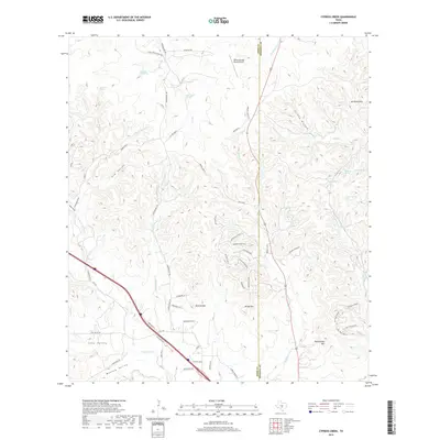
2019 Map of Cypress Creek
USGS Topo · Published 2019About this map
Cypress Cr winds through the limestone hills and valleys of the eastern Edwards Plateau along the Kerr Co and Kendall Co line. The landscape is defined by its numerous springs and drainage patterns, with Sycamore Spring, Bear Creek Spring, and Coyote Spring feeding a complex network of creeks that have carved out features like Elm Valley and Turkey Hollow. Ranching infrastructure is prominent, notably at the Flat Rock Ranch and the Indian Springs Ranch Airport. Significant topographic landmarks rise above the valley floors, including Rattlesnake Mtn, Pointed Mtn, and the No Name Hills. The road network consists primarily of family-named ranch roads and rural lanes, such as Holekamp Rd N and Poehnert Ln, tracing the historical property divisions of this Texas Hill Country terrain.
Find a feature on this map
62 named features on this map. Tap any name to fly to it.
Don’t see what you’re looking for? This feature index may not catch every label — zoom into the map to look around manually.
Map Details
Editions of this 2019 Cypress Creek Map
This is the sole edition of this map. No revisions or reprints were ever made.
Other maps of this area

1894 · Fredericksburg
USGS Topo · 1:125,000

1894 · Kerrville
USGS Topo · 1:125,000

1954 · Llano
USGS Topo · 1:250,000

1954 · San Antonio
USGS Topo · 1:250,000

1955 · Llano
USGS Topo · 1:250,000

1956 · Comfort
USGS Topo · 1:62,500

1956 · Center Point
USGS Topo · 1:62,500

1956 · Llano
USGS Topo · 1:250,000

1957 · San Antonio
USGS Topo · 1:250,000

1963 · Cain City
USGS Topo · 1:24,000