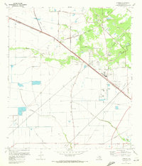
1970 Map of Cypress
USGS Topo · Published 1972About this map
Cypress and the surrounding Harris County prairie are captured here during a period of transition, where established ranching and agricultural roots meet the expanding reach of Houston. The Southern Pacific railroad corridor serves as the primary axis for development, passing through the settlement and near the historic waters of Hot Wells. The landscape is defined by an intricate network of drainage, from the prominent Cypress Creek to the southern expanse of Addicks Reservoir, reflecting the region's relationship with the Gulf Coast watershed.
Find a feature on this map
40 named features on this map. Tap any name to fly to it.
Don’t see what you’re looking for? This feature index may not catch every label — zoom into the map to look around manually.
Map Details
Editions of this 1970 Cypress Map
3 editions found
Other maps of this area

1915 · Cypress
USGS Topo · 1:24,000

1915 · Katy
USGS Topo · 1:24,000

1915 · Addicks
USGS Topo · 1:24,000

1915 · Hillendahl
USGS Topo · 1:24,000

1916 · Rose Hill
USGS Topo · 1:24,000

1916 · Louetta
USGS Topo · 1:24,000

1916 · Hockley
USGS Topo · 1:24,000

1916 · Satsuma
USGS Topo · 1:24,000

1916 · Swanson
USGS Topo · 1:24,000

1918 · Cypress
USGS Topo · 1:31,680