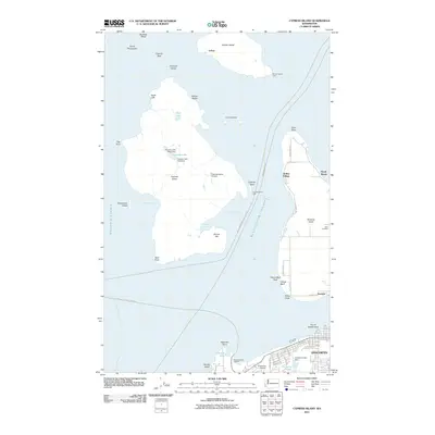
2011 Map of Cypress Island
USGS Topo · Published 2011About this map
Cypress Island and its surrounding archipelago define this maritime landscape in the San Juan Islands, where early 21st-century conservation and small-town infrastructure meet. To the north, Sinclair Island features the settlement of Urban and the Sinclair Island Light, while the southern reaches are anchored by the city of Anacortes. The map reveals a complex interface of land and sea, from the industrial and residential grid near Cranberry Lake to the rugged coastline of Guemes Island, home to the Eden Cemetery. Significant engineering is visible on Cypress Island with the Cypress Lake West Dam and Cypress Lake East Dam, which manage upland water resources. Transportation remains central to the region's identity, evidenced by the Anacortes Ferry Landing and the Cypress Island Airport, facilitating movement across the Bellingham Channel and Rosario Strait.
Find a feature on this map
59 named features on this map. Tap any name to fly to it.
Don’t see what you’re looking for? This feature index may not catch every label — zoom into the map to look around manually.
Map Details
Editions of this 2011 Cypress Island Map
This is the sole edition of this map. No revisions or reprints were ever made.
Other maps of this area

1943 · Richardson
USGS Topo · 1:62,500

1943 · Orcas Island
USGS Topo · 1:62,500

1943 · Deception Pass
USGS Topo · 1:62,500

1943 · Anacortes
USGS Topo · 1:62,500

1951 · Deception Pass
USGS Topo · 1:62,500

1951 · Anacortes
USGS Topo · 1:62,500

1957 · Richardson
USGS Topo · 1:62,500

1957 · Orcas Island
USGS Topo · 1:62,500

1957 · Victoria
USGS Topo · 1:250,000

1973 · Cypress Island
USGS Topo · 1:24,000