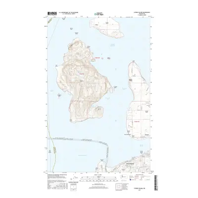
2017 Map of Cypress Island
USGS Topo · Published 2017About this map
Cypress Island and its surrounding archipelago define this maritime landscape in Puget Sound, illustrating a complex network of island settlements and mainland terminals. The northern reach includes Urban on Sinclair Island, while the eastern flank is dominated by Guemes Island, featuring the Eden Cem and the community of Indian Village. The intricate topography of Cypress Island is marked by features like Eagle Cliff, Secret Harbor, and inland water bodies such as Duck Lake and Cypress Lake. To the south, the city of Anacortes serves as a vital transportation hub. This is evidenced by the numerous ferry routes radiating from the Ferry Terminal Rd, including paths to Orcas Island and Friday Harbor. The proximity of the Anacortes Airport and the city's street grid, including Oakes Ave, highlights the interface between the rocky island terrain and the developed shoreline of the mainland.
Find a feature on this map
75 named features on this map. Tap any name to fly to it.
Don’t see what you’re looking for? This feature index may not catch every label — zoom into the map to look around manually.
Map Details
Editions of this 2017 Cypress Island Map
This is the sole edition of this map. No revisions or reprints were ever made.
Other maps of this area

1943 · Richardson
USGS Topo · 1:62,500

1943 · Orcas Island
USGS Topo · 1:62,500

1943 · Deception Pass
USGS Topo · 1:62,500

1943 · Anacortes
USGS Topo · 1:62,500

1951 · Deception Pass
USGS Topo · 1:62,500

1951 · Anacortes
USGS Topo · 1:62,500

1957 · Richardson
USGS Topo · 1:62,500

1957 · Orcas Island
USGS Topo · 1:62,500

1957 · Victoria
USGS Topo · 1:250,000

1973 · Cypress Island
USGS Topo · 1:24,000