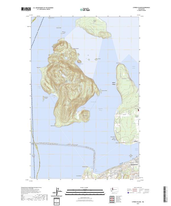
2023 Map of Cypress Island
USGS Topo · Published 2023About this map
Cypress Island serves as the centerpiece of this coastal survey, where the terrestrial and maritime geography of the northern Puget Sound meet. High points like Eagle Cliff and Olivine Hill overlook a network of coves and bays, including Secret Harbor and Strawberry Bay, that have long defined local navigation. Much of the island is preserved within the San Juan Islands National Monument, reflecting its protected status.
Find a feature on this map
70 named features on this map. Tap any name to fly to it.
Don’t see what you’re looking for? This feature index may not catch every label — zoom into the map to look around manually.
Map Details
Editions of this 2023 Cypress Island Map
This is the sole edition of this map. No revisions or reprints were ever made.
Other maps of this area

1943 · Richardson
USGS Topo · 1:62,500

1943 · Orcas Island
USGS Topo · 1:62,500

1943 · Deception Pass
USGS Topo · 1:62,500

1943 · Anacortes
USGS Topo · 1:62,500

1951 · Deception Pass
USGS Topo · 1:62,500

1951 · Anacortes
USGS Topo · 1:62,500

1957 · Richardson
USGS Topo · 1:62,500

1957 · Orcas Island
USGS Topo · 1:62,500

1957 · Victoria
USGS Topo · 1:250,000

1973 · Cypress Island
USGS Topo · 1:24,000