
1968 Map of Cyrus
USGS Topo · Published 1970About this map
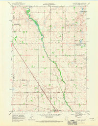
Cyrus serves as the primary hub in this West Central Minnesota landscape, situated along the Northern Pacific railroad line just east of the Stevens Co Pope Co line. The area is characterized by a dense network of wetlands and conservation lands, including the Noordmans State Wildlife Management Area and several larger tracts designated as National Wildlife Management Area. The Chippewa River and its tributary, the Little Chippewa River, meander through the townships of New Prairie and Walden, connecting a series of significant water bodies such as Lake Emily and White Bear Lake. For genealogists, the map preserves the locations of vital community landmarks, from the St Petri Cem and Cyrus Cem in the northwest to the Lake Emily Cem and the rural Immanuel Ch further south and east.
Find a feature on this map
20 named features on this map. Tap any name to fly to it.
Don’t see what you’re looking for? This feature index may not catch every label — zoom into the map to look around manually.
Map Details
Editions of this 1968 Cyrus Map
This is the sole edition of this map. No revisions or reprints were ever made.
Other maps of this area

1912 · Morris
USGS Topo · 1:62,500

1953 · Saint Cloud
USGS Topo · 1:250,000

1957 · Saint Cloud
USGS Topo · 1:250,000

1958 · Saint Cloud
USGS Topo · 1:250,000

1968 · Starbuck
USGS Topo · 1:24,000

1968 · Lowry
USGS Topo · 1:24,000

1968 · Hancock
USGS Topo · 1:24,000

1968 · Lake Hassel
USGS Topo · 1:24,000

1968 · Starbuck NW
USGS Topo · 1:24,000
1968 · Clontarf North
USGS Topo · 1:24,000