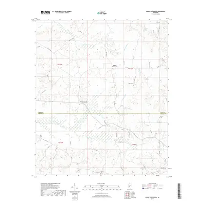
2018 Map of Dabney Crossroads
USGS Topo · Published 2018About this map
Dabney Crossroads and Thompsonville anchor this rural landscape along the boundary of Hinds and Copiah Counties. The terrain is defined by a dense network of tributaries including White Oak Creek, Little Tallahalla Cr, and Hurricane Cr, which carve through the countryside near Turkey Hollow. For genealogists and local researchers, several burial grounds are preserved across these townships, including Miller Springs Cem in the west and Old Crystal Springs Cem located near the southern margin. The map traces numerous named local routes and trails, such as Camp Turnage Trails Rd and Prentiss Crump Rd, which connect scattered homesteads and small family plots. This document provides a clear view of the traditional land divisions and road networks that have long defined these Mississippi crossroads communities.
Find a feature on this map
62 named features on this map. Tap any name to fly to it.
Don’t see what you’re looking for? This feature index may not catch every label — zoom into the map to look around manually.
Map Details
Editions of this 2018 Dabney Crossroads Map
This is the sole edition of this map. No revisions or reprints were ever made.
Other maps of this area

1903 · Jackson
USGS Topo · 1:125,000

1937 · Terry
USGS Topo · 1:48,000

1943 · Terry
USGS Topo · 1:62,500

1953 · Natchez
USGS Topo · 1:250,000

1955 · Jackson
USGS Topo · 1:250,000

1956 · Natchez
USGS Topo · 1:250,000

1959 · Natchez
USGS Topo · 1:250,000

1961 · Jackson
USGS Topo · 1:250,000

1962 · Jackson
USGS Topo · 1:250,000

1963 · Dentville
USGS Topo · 1:24,000