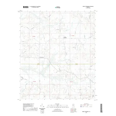
2020 Map of Dabney Crossroads
USGS Topo · Published 2020About this map
Dabney Crossroads sits at the center of this rural landscape where the topography is defined by the headwaters of several critical drainages. The area transition is marked by the Hinds Co and Copiah Co line, with the terrain falling away toward White Oak Creek and the southern Little White Oak Cr. Local genealogy is well-represented through family-named sites and burial grounds such as Miller Springs Cem in the southwest and Old Crystal Springs Cem near the eastern boundary. The road network, including Prentiss Crump Rd and Gallatin Rd, follows the ridges between the numerous branches and creeks, such as Rosa May Br and Falling Spring Br. The small settlement of Thompsonville remains a key landmark in this agrarian pocket of central Mississippi, providing a clear view of the land's contemporary development and preserved natural features.
Find a feature on this map
59 named features on this map. Tap any name to fly to it.
Don’t see what you’re looking for? This feature index may not catch every label — zoom into the map to look around manually.
Map Details
Editions of this 2020 Dabney Crossroads Map
This is the sole edition of this map. No revisions or reprints were ever made.
Other maps of this area

1903 · Jackson
USGS Topo · 1:125,000

1937 · Terry
USGS Topo · 1:48,000

1943 · Terry
USGS Topo · 1:62,500

1953 · Natchez
USGS Topo · 1:250,000

1955 · Jackson
USGS Topo · 1:250,000

1956 · Natchez
USGS Topo · 1:250,000

1959 · Natchez
USGS Topo · 1:250,000

1961 · Jackson
USGS Topo · 1:250,000

1962 · Jackson
USGS Topo · 1:250,000

1963 · Dentville
USGS Topo · 1:24,000