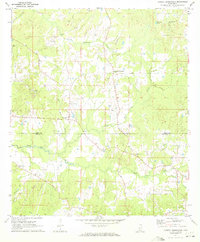
1971 Map of Dabney Crossroads
USGS Topo · Published 1973About this map
Dabney Crossroads serves as a central landmark in this 1970s Mississippi landscape, marking a quiet rural intersection where local roads converge. The area is defined by a series of winding waterways including Little Tallahalla Creek and White Oak Creek, which drain the timbered and agricultural lands along the border of Hinds and Copiah counties. This survey reflects the dispersed settlement patterns typical of the region, where community life centered on landmarks like Thompsonville and a network of country congregations.
Find a feature on this map
23 named features on this map. Tap any name to fly to it.
Don’t see what you’re looking for? This feature index may not catch every label — zoom into the map to look around manually.
Map Details
Editions of this 1971 Dabney Crossroads Map
This is the sole edition of this map. No revisions or reprints were ever made.
Other maps of this area

1903 · Jackson
USGS Topo · 1:125,000

1937 · Terry
USGS Topo · 1:48,000

1943 · Terry
USGS Topo · 1:62,500

1953 · Natchez
USGS Topo · 1:250,000

1955 · Jackson
USGS Topo · 1:250,000

1956 · Natchez
USGS Topo · 1:250,000

1959 · Natchez
USGS Topo · 1:250,000

1961 · Jackson
USGS Topo · 1:250,000

1962 · Jackson
USGS Topo · 1:250,000

1963 · Dentville
USGS Topo · 1:24,000