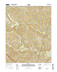
2016 Map of Dabneys
USGS Topo · Published 2016About this map
The South Anna River and the Newfound River carve through this central Virginia landscape where Louisa, Hanover, and Goochland counties converge. Small settlements like Dabneys and Holly Grove are connected by a network of rural routes, including Bethany Church Rd and Turners Mill Rd, reflecting the area's agricultural and milling roots. Historical water management is evident at Sheltons Millpond, while modern aviation is represented by the Holly Springs Airport near the center of the quadrangle.
Find a feature on this map
96 named features on this map. Tap any name to fly to it.
Don’t see what you’re looking for? This feature index may not catch every label — zoom into the map to look around manually.
Map Details
Editions of this 2016 Dabneys Map
This is the sole edition of this map. No revisions or reprints were ever made.
Other maps of this area

1890 · Goochland
USGS Topo · 1:125,000

1892 · Goochland
USGS Topo · 1:125,000

1942 · Pendleton
USGS Topo · 1:24,000

1942 · Buckner
USGS Topo · 1:24,000

1942 · Beaverdam
USGS Topo · 1:24,000

1943 · Goochland
USGS Topo · 1:31,680

1943 · Mabelton
USGS Topo · 1:31,680

1943 · Perkinsville
USGS Topo · 1:31,680

1943 · Pendleton
USGS Topo · 1:31,680
1943 · Buckner
USGS Topo · 1:31,680