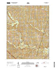
2019 Map of Dabneys
USGS Topo · Published 2019About this map
The South Anna River winds through this rural landscape where the boundaries of Louisa, Hanover, and Goochland counties converge. Central to this map is the settlement of Holly Grove, situated near the Holly Springs Airport and the waters of Sheltons Millpond. This 2019 survey documents a region defined by its hydrography, with numerous named drainages including Leatherwood Cr, Fleming Cr, and Locust Cr feeding into the larger river system.
Find a feature on this map
100 named features on this map. Tap any name to fly to it.
Don’t see what you’re looking for? This feature index may not catch every label — zoom into the map to look around manually.
Map Details
Editions of this 2019 Dabneys Map
This is the sole edition of this map. No revisions or reprints were ever made.
Other maps of this area

1890 · Goochland
USGS Topo · 1:125,000

1892 · Goochland
USGS Topo · 1:125,000

1942 · Pendleton
USGS Topo · 1:24,000

1942 · Buckner
USGS Topo · 1:24,000

1942 · Beaverdam
USGS Topo · 1:24,000

1943 · Goochland
USGS Topo · 1:31,680

1943 · Mabelton
USGS Topo · 1:31,680

1943 · Perkinsville
USGS Topo · 1:31,680

1943 · Pendleton
USGS Topo · 1:31,680
1943 · Buckner
USGS Topo · 1:31,680