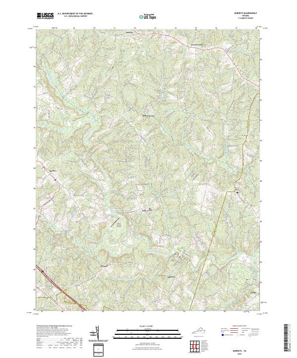
2022 Map of Dabneys
USGS Topo · Published 2022About this map
The South Anna River and its numerous tributaries, including Leatherwood Cr and Flemings Cr, define this landscape of rural crossroads and wooded acreage on the border of Louisa, Hanover, and Goochland Counties. Small communities like Dabneys and Holly Grove are central to this 2022 survey, reflecting a region that maintains its traditional settlement patterns. The presence of Sheltons Millpond and Hopeful Baptist Church Cem offers significant points of interest for local historians and genealogists, providing a modern record of landmarks that have anchored this part of Virginia for generations.
Find a feature on this map
105 named features on this map. Tap any name to fly to it.
Don’t see what you’re looking for? This feature index may not catch every label — zoom into the map to look around manually.
Map Details
Editions of this 2022 Dabneys Map
This is the sole edition of this map. No revisions or reprints were ever made.
Other maps of this area

1890 · Goochland
USGS Topo · 1:125,000

1892 · Goochland
USGS Topo · 1:125,000

1942 · Pendleton
USGS Topo · 1:24,000

1942 · Buckner
USGS Topo · 1:24,000

1942 · Beaverdam
USGS Topo · 1:24,000

1943 · Goochland
USGS Topo · 1:31,680

1943 · Mabelton
USGS Topo · 1:31,680

1943 · Perkinsville
USGS Topo · 1:31,680

1943 · Pendleton
USGS Topo · 1:31,680
1943 · Buckner
USGS Topo · 1:31,680