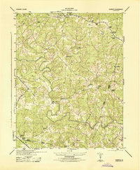
1944 Map of Dabneys
USGS Topo · Published 1944About this map
The South Anna River winds through this 1944 survey, carving a path between the rural boundaries of Louisa and Goochland counties. The landscape is defined by its small crossroads settlements and family-run commercial hubs, including Bagby Store and Duggins Store near the Hanover border. Religious and educational life is well-documented through a dense network of country congregations like Salem Church, Mt Hope Church, and Hopeful Church, alongside the Mt Zion School. A significant industrial landmark, Dunns Mill, appears near Inez, signaling the agricultural and water-powered economy of the mid-century Piedmont. The topography is characterized by the numerous tributaries feeding the South Anna, such as Cub Creek and Taylors Creek, which dictated the location of early roads and small communities like Shelfar and Dabneys.
Find a feature on this map
32 named features on this map. Tap any name to fly to it.
Don’t see what you’re looking for? This feature index may not catch every label — zoom into the map to look around manually.
Map Details
Editions of this 1944 Dabneys Map
This is the sole edition of this map. No revisions or reprints were ever made.
Other maps of this area

1890 · Goochland
USGS Topo · 1:125,000

1892 · Goochland
USGS Topo · 1:125,000

1942 · Pendleton
USGS Topo · 1:24,000

1942 · Buckner
USGS Topo · 1:24,000

1942 · Beaverdam
USGS Topo · 1:24,000

1943 · Goochland
USGS Topo · 1:31,680

1943 · Mabelton
USGS Topo · 1:31,680

1943 · Perkinsville
USGS Topo · 1:31,680

1943 · Pendleton
USGS Topo · 1:31,680
1943 · Buckner
USGS Topo · 1:31,680