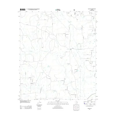
2013 Map of Dacus
USGS Topo · Published 2013About this map
Dacus and the small settlement of Blackberry define this portion of Montgomery County, where a network of rural roads and watercourses shapes the local landscape. The geography is heavily influenced by the drainage systems of Little Caney Cr and Caney Cr, which converge in the south near Sand Cr. A history of family and community can be traced through the placement of Bethel Cem, Waller Cem, and Post Oak Cem, each situated along the thoroughfares that connect these scattered residential pockets. FM 1486 Rd serves as a primary north-south artery, while specialized routes like J D Ranch Rd and Watson Ranch Rd indicate the area's agricultural and ranching character. In the northern reaches, Patterson Lake and Kidhaw Br provide distinct landmarks in a terrain characterized by dense creek beds and wooded parcels.
Find a feature on this map
64 named features on this map. Tap any name to fly to it.
Don’t see what you’re looking for? This feature index may not catch every label — zoom into the map to look around manually.
Map Details
Editions of this 2013 Dacus Map
This is the sole edition of this map. No revisions or reprints were ever made.
Other maps of this area

1954 · Beaumont
USGS Topo · 1:250,000

1957 · Beaumont
USGS Topo · 1:250,000

1959 · San Jacinto
USGS Topo · 1:24,000

1959 · Montgomery
USGS Topo · 1:24,000

1961 · Anderson
USGS Topo · 1:24,000

1961 · Stoneham
USGS Topo · 1:24,000

1962 · Keenan
USGS Topo · 1:24,000

1962 · Dacus
USGS Topo · 1:24,000

1962 · Plantersville
USGS Topo · 1:24,000

1962 · Richards
USGS Topo · 1:24,000