
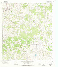
1961 Map of Anderson
USGS Topo · Published 1964About this map
Anderson serves as the focal point of this East Texas landscape, where the town's early layout is preserved alongside agricultural lands and wooded creek bottoms. The presence of St Stanislaus Ch and several rural congregations including Pleasant Grove Ch and Cokesbury Ch highlights the importance of faith and community centers in Grimes County during the mid-century. An Old Railroad Grade cutting across the northern terrain serves as a physical reminder of past transportation routes that once linked these small settlements.
Find a feature on this map
23 named features on this map. Tap any name to fly to it.
Don’t see what you’re looking for? This feature index may not catch every label — zoom into the map to look around manually.
Map Details
Editions of this 1961 Anderson Map
2 editions found
Other maps of this area

1914 · Navasota
USGS Topo · 1:62,500

1954 · Beaumont
USGS Topo · 1:250,000

1954 · Austin
USGS Topo · 1:250,000

1956 · Carlos
USGS Topo · 1:62,500

1957 · Beaumont
USGS Topo · 1:250,000

1958 · Navasota
USGS Topo · 1:24,000

1958 · Courtney
USGS Topo · 1:24,000

1960 · Carlos
USGS Topo · 1:24,000

1961 · Stoneham
USGS Topo · 1:24,000

1962 · Dacus
USGS Topo · 1:24,000