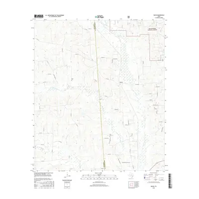
2016 Map of Dacus
USGS Topo · Published 2016About this map
The community of Dacus lies at the heart of this landscape where the Grimes and Montgomery county lines meet. The terrain is defined by a dense network of waterways including Little Caney Creek, Johns Creek, and Madden Branch that carve through the piney woods and pastureland of Southeast Texas. To the northeast, the Sam Houston National Forest marks a protected wilderness boundary, while Patterson Lake sits near the headwaters of Lake Creek. Local genealogy is well-preserved through several family and community landmarks, such as Bethel Cemetery near the forest edge, Waller Cemetery to the west, and Post Oak Cemetery along Post Oak Cemetery Road. The road network, including FM 1486, connects rural residences and ranches, reflecting the area's continued role as a timber and agricultural hub.
Find a feature on this map
62 named features on this map. Tap any name to fly to it.
Don’t see what you’re looking for? This feature index may not catch every label — zoom into the map to look around manually.
Map Details
Editions of this 2016 Dacus Map
This is the sole edition of this map. No revisions or reprints were ever made.
Other maps of this area

1954 · Beaumont
USGS Topo · 1:250,000

1957 · Beaumont
USGS Topo · 1:250,000

1959 · San Jacinto
USGS Topo · 1:24,000

1959 · Montgomery
USGS Topo · 1:24,000

1961 · Anderson
USGS Topo · 1:24,000

1961 · Stoneham
USGS Topo · 1:24,000

1962 · Keenan
USGS Topo · 1:24,000

1962 · Dacus
USGS Topo · 1:24,000

1962 · Plantersville
USGS Topo · 1:24,000

1962 · Richards
USGS Topo · 1:24,000