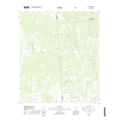
2019 Map of Dacus
USGS Topo · Published 2019About this map
The boundary between Montgomery Co and Grimes Co bisects this landscape, where the rural settlement of Dacus serves as a central point for local travel along FM 1486. To the northeast, the Sam Houston National Forest reaches into the quadrangle near Patterson Lake, providing a wooded contrast to the scattered residential developments and farms that define the rest of the area. Family and community history are preserved in several locations, including Waller Cem, Post Oak Cem, and Bethel Cem. Drainage is defined by a dense network of small waterways, such as Little Caney Cr, Johns Cr, and Madden Br, which flow through the rolling terrain. The road network, including Co RD 243 and FM 1774, illustrates the modern connectivity of this region while respecting the historical placement of original homesteads and cemeteries.
Find a feature on this map
63 named features on this map. Tap any name to fly to it.
Don’t see what you’re looking for? This feature index may not catch every label — zoom into the map to look around manually.
Map Details
Editions of this 2019 Dacus Map
This is the sole edition of this map. No revisions or reprints were ever made.
Other maps of this area

1954 · Beaumont
USGS Topo · 1:250,000

1957 · Beaumont
USGS Topo · 1:250,000

1959 · San Jacinto
USGS Topo · 1:24,000

1959 · Montgomery
USGS Topo · 1:24,000

1961 · Anderson
USGS Topo · 1:24,000

1961 · Stoneham
USGS Topo · 1:24,000

1962 · Keenan
USGS Topo · 1:24,000

1962 · Dacus
USGS Topo · 1:24,000

1962 · Plantersville
USGS Topo · 1:24,000

1962 · Richards
USGS Topo · 1:24,000