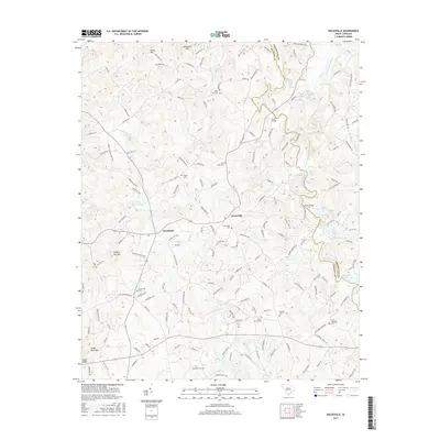
2017 Map of Dacusville
USGS Topo · Published 2017About this map
The community of Dacusville serves as the focal point for this survey along the boundary of Pickens and Greenville Counties. The landscape is defined by the three forks of the Saluda River, including the South Saluda River and North Saluda River, which drain the foothills near Alexander Hill and Jones Hill. This region is characterized by small-scale farming and residential growth, with historical continuity preserved in a high density of family and community burial grounds such as Nine Forks Cem and Hunts Memorial Cem. Significant water features like Rutledge Lake and Belue Lake are scattered among the ridges, while the western edge of the area is marked by the distinct summits of Hickory Nut Mtn and Cedar Rock Mtn. The road network connects older settlements like Hendricks to the larger river valleys, tracing the paths of long-established local routes.
Find a feature on this map
162 named features on this map. Tap any name to fly to it.
Don’t see what you’re looking for? This feature index may not catch every label — zoom into the map to look around manually.
Map Details
Editions of this 2017 Dacusville Map
This is the sole edition of this map. No revisions or reprints were ever made.
Other maps of this area

1888 · Pickens
USGS Topo · 1:125,000

1894 · Pickens
USGS Topo · 1:125,000

1905 · Pisgah
USGS Topo · 1:125,000

1906 · Pisgah
USGS Topo · 1:125,000

1907 · Saluda
USGS Topo · 1:125,000

1935 · Greenville
USGS Topo · 1:48,000

1935 · Table Rock
USGS Topo · 1:24,000

1938 · Greenville
USGS Topo · 1:62,500
1946 · Table Rock
USGS Topo · 1:24,000
1947 · Table Rock
USGS Topo · 1:24,000