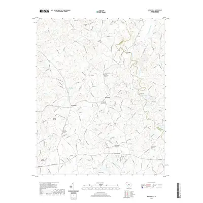
2020 Map of Dacusville
USGS Topo · Published 2020About this map
Dacusville and Hendricks serve as the primary crossroads in this portion of Pickens County, where the landscape is defined by the winding descent of the North Saluda River and South Saluda River. The map reveals a high concentration of institutional history, with numerous long-standing congregations such as Nine Forks Baptist Church and Dacusville United Methodist Church anchoring their respective communities. These sites, often paired with older burial grounds like the Nine Forks Graveyard or the Mount Carmel Graveyard, suggest a deep-rooted social fabric focused around these rural centers.
Find a feature on this map
187 named features on this map. Tap any name to fly to it.
Don’t see what you’re looking for? This feature index may not catch every label — zoom into the map to look around manually.
Map Details
Editions of this 2020 Dacusville Map
This is the sole edition of this map. No revisions or reprints were ever made.
Other maps of this area

1888 · Pickens
USGS Topo · 1:125,000

1894 · Pickens
USGS Topo · 1:125,000

1905 · Pisgah
USGS Topo · 1:125,000

1906 · Pisgah
USGS Topo · 1:125,000

1907 · Saluda
USGS Topo · 1:125,000

1935 · Greenville
USGS Topo · 1:48,000

1935 · Table Rock
USGS Topo · 1:24,000

1938 · Greenville
USGS Topo · 1:62,500
1946 · Table Rock
USGS Topo · 1:24,000
1947 · Table Rock
USGS Topo · 1:24,000