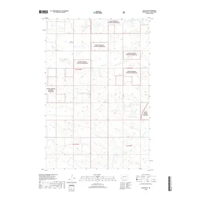
2018 Map of Daglum SW
USGS Topo · Published 2018About this map
The Little Missouri National Grassland dominates this section of Slope County, where the high plains transition into the drainage systems of the Missouri River watershed. This modern 2018 survey reveals a landscape of sparse human habitation defined largely by section lines and natural watercourses. The most significant historical landmark is the Peaceful Valley Cem, located near the northern edge of the map, providing a vital point of reference for genealogists researching early settlement families in this part of North Dakota. Water management and natural flow are traced through the Cannonball River and its smaller tributaries, including Philbrick Cr and Adobe Wall Cr. The local road network follows a strict grid, with routes like 54th St SW and 134th Ave SW providing access through the public lands of the national grassland.
Find a feature on this map
14 named features on this map. Tap any name to fly to it.
Don’t see what you’re looking for? This feature index may not catch every label — zoom into the map to look around manually.
Map Details
Editions of this 2018 Daglum SW Map
This is the sole edition of this map. No revisions or reprints were ever made.
Other maps of this area

1953 · Dickinson
USGS Topo · 1:250,000

1957 · Dickinson
USGS Topo · 1:250,000

1961 · Daglum
USGS Topo · 1:62,500

1961 · Rocky Ridge
USGS Topo · 1:62,500

1973 · White Lake
USGS Topo · 1:24,000

1973 · Amidon
USGS Topo · 1:24,000

1973 · West Rainy Butte
USGS Topo · 1:24,000

1980 · Belfield
USGS Topo · 1:100,000

1981 · Bowman
USGS Topo · 1:100,000
1982 · Daglum NW
USGS Topo · 1:24,000