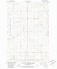
1982 Map of Daglum NW
USGS Topo · Published 1982About this map
Little Missouri National Grassland dominates this corner of the Dakota prairie, where the convergence of Billings, Stark, and Slope counties reveals a landscape defined by drainage and resource extraction. The map captures a transition in the local economy during the early 1980s, documenting the Rocky Ridge Oil Field in the southwest near the broken terrain of the river forks. This industrial presence contrasts with the quiet landmarks of the region's homesteading history, such as Our Lady of Lourdes Ch and the small settlements of Gaylord and Ouellette. Waterways like Adobe Wall Creek and Bull Creek carve into the high plains, providing the essential geographic structure for the scattered ranching and energy operations that comprise the area's rural character.
Find a feature on this map
11 named features on this map. Tap any name to fly to it.
Don’t see what you’re looking for? This feature index may not catch every label — zoom into the map to look around manually.
Map Details
Editions of this 1982 Daglum NW Map
This is the sole edition of this map. No revisions or reprints were ever made.
Other maps of this area

1953 · Dickinson
USGS Topo · 1:250,000

1957 · Dickinson
USGS Topo · 1:250,000

1961 · Daglum
USGS Topo · 1:62,500

1961 · Rocky Ridge
USGS Topo · 1:62,500

1962 · Belfield SW
USGS Topo · 1:24,000

1962 · Fryburg
USGS Topo · 1:24,000

1962 · Belfield SE
USGS Topo · 1:24,000

1980 · Belfield
USGS Topo · 1:100,000
1982 · Daglum SW
USGS Topo · 1:24,000
1982 · Daglum SE
USGS Topo · 1:24,000