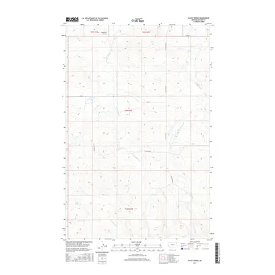
2017 Map of Dailey Spring
USGS Topo · Published 2017About this map
Dailey Spring and Barrel Springs anchor a sparse landscape of high-plains drainage networks in this 2017 survey of eastern Montana. The map detail highlights the complex branching of Sand Creek, specifically W Fork Sand Cr, Middle Fork Sand Cr, and E Fork Sand Cr, which carve through the open terrain alongside Porcupine Cr and Coal Cr. This geography of coulees and intermittent water sources, such as Dead Man Coulee, reflects the essential water-management infrastructure of McCone County. Man-made features like Tveten Reservoir and the long stretches of Hubbard Rd and Pass Rd illustrate how this remote ranching country was organized and accessed into the early 21st century.
Find a feature on this map
17 named features on this map. Tap any name to fly to it.
Don’t see what you’re looking for? This feature index may not catch every label — zoom into the map to look around manually.
Map Details
Editions of this 2017 Dailey Spring Map
This is the sole edition of this map. No revisions or reprints were ever made.
Other maps of this area

1954 · Glendive
USGS Topo · 1:250,000

1957 · Glendive
USGS Topo · 1:250,000

1958 · Glendive
USGS Topo · 1:250,000

1983 · Hudiburgh Reservoir
USGS Topo · 1:24,000

1983 · Pedigo Coulee
USGS Topo · 1:24,000

1983 · Dailey Spring
USGS Topo · 1:24,000

1983 · Hudiburgh Reservoir NW
USGS Topo · 1:24,000
1983 · Sadie Coulee
USGS Topo · 1:24,000
1983 · Lone Pine School
USGS Topo · 1:24,000
1983 · Rock Creek
USGS Topo · 1:24,000