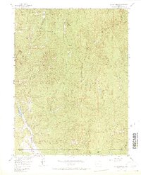
1956 Map of Dakan Mountain
USGS Topo · Published 1971About this map
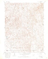
Dakan Mountain and the surrounding Rampart Range dominate this mid-century topographical survey of Douglas County. The landscape is characterized by steep drainage networks and high peaks like Turtle Mountain and Storm Peak, set within the protected lands of the Pike National Forest. Evidence of early resource extraction is visible in scattered mines and quarries near Missouri Gulch and Illinois Creek.
Find a feature on this map
27 named features on this map. Tap any name to fly to it.
Don’t see what you’re looking for? This feature index may not catch every label — zoom into the map to look around manually.
Map Details
Editions of this 1956 Dakan Mountain Map
7 editions found
Other maps of this area

1893 · Platte Canyon
USGS Topo · 1:125,000

1894 · Castle Rock
USGS Topo · 1:125,000

1913 · Castle Rock
USGS Topo · 1:125,000

1940 · Castle Rock
USGS Topo · 1:62,500

1945 · Castle Rock
USGS Topo · 1:62,500

1953 · Denver
USGS Topo · 1:250,000

1954 · Devils Head
USGS Topo · 1:24,000

1954 · Deckers
USGS Topo · 1:24,000

1954 · Mount Deception
USGS Topo · 1:24,000
1954 · Palmer Lake
USGS Topo · 1:24,000