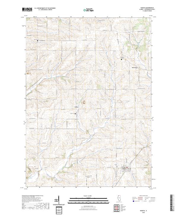
2024 Map of Dakota
USGS Topo · Published 2024About this map
The village of Dakota and the unincorporated communities of Rock Grove and Afolkey anchor this modern-day Stephenson County landscape. The area is defined by a dendritic network of waterways including Brush Creek, Cedar Creek, and Rock Run, which carve through the agricultural terrain. Significant for local historians and genealogists, the map identifies several distinct burial sites such as Eldorado Cem, Rock Grove Union Cem, Afolkey Cem, and Dakota Cem, often located near their namesake settlements. To the south, the Freeport/Dornink Airport stands as a notable modern landmark. The infrastructure follows a grid-like pattern of rural roads, including Co HWY 4 and Co HWY 19, which provide access to the various farmsteads and small population centers that have persisted in this corner of Illinois.
Find a feature on this map
65 named features on this map. Tap any name to fly to it.
Don’t see what you’re looking for? This feature index may not catch every label — zoom into the map to look around manually.
Map Details
Editions of this 2024 Dakota Map
This is the sole edition of this map. No revisions or reprints were ever made.
Other maps of this area

1893 · Brodhead
USGS Topo · 1:62,500

1920 · Monroe
USGS Topo · 1:62,500

1922 · Monroe
USGS Topo · 1:62,500

1932 · Pecatonica
USGS Topo · 1:62,500

1936 · Pecatonica
USGS Topo · 1:62,500

1939 · Freeport
USGS Topo · 1:48,000

1944 · Freeport
USGS Topo · 1:62,500

1954 · Rockford
USGS Topo · 1:250,000

1955 · Rockford
USGS Topo · 1:250,000

1958 · Rockford
USGS Topo · 1:250,000