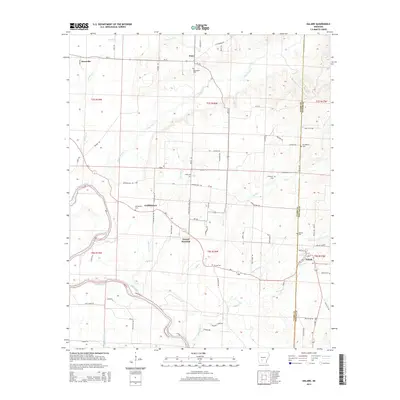
2014 Map of Dalark
USGS Topo · Published 2014About this map
The Ouachita River winds through the southwestern corner of this Clark and Dallas County borderland, defining a landscape of creek bottoms and low ridges. Small, established settlements such as Dalark, Gravel Junction, and Griffithtown serve as focal points for a network of rural routes, including Ar-51 and Ar-128. The distribution of family and community burial grounds, such as Bethlehem Cem, Macedonia Cem, and McClanahan Cem, indicates a deeply rooted residential pattern in this part of Arkansas.
Find a feature on this map
77 named features on this map. Tap any name to fly to it.
Don’t see what you’re looking for? This feature index may not catch every label — zoom into the map to look around manually.
Map Details
Editions of this 2014 Dalark Map
This is the sole edition of this map. No revisions or reprints were ever made.
Other maps of this area

1901 · Gurdon
USGS Topo · 1:125,000

1903 · Camden
USGS Topo · 1:125,000

1953 · El Dorado
USGS Topo · 1:250,000

1955 · Little Rock
USGS Topo · 1:250,000

1956 · Little Rock
USGS Topo · 1:250,000

1957 · El Dorado
USGS Topo · 1:250,000

1958 · El Dorado
USGS Topo · 1:250,000

1959 · Caddo Valley
USGS Topo · 1:24,000

1959 · Arkadelphia
USGS Topo · 1:24,000

1960 · El Dorado
USGS Topo · 1:250,000