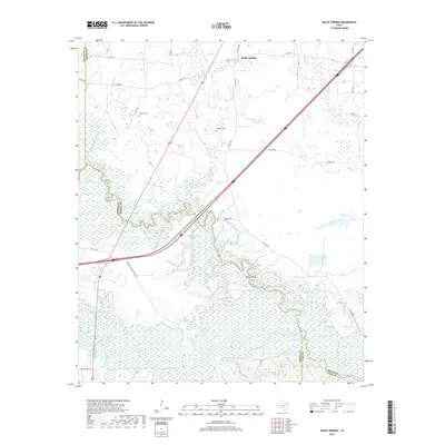
2019 Map of Dalby Springs
USGS Topo · Published 2019About this map
The low-lying river bottoms of the Sulphur River and White Oak Creek dominate this corner of Northeast Texas, where the boundaries of Bowie, Morris, and Cass counties converge. This environment is characterized by a complex network of sloughs and floodplain lakes, including Molly Clark Slough, Parker Lake, and Greenhaw Lake. These water features suggest a landscape shaped by seasonal flooding and shifting river channels, historically vital for local drainage and timbering operations.
Find a feature on this map
47 named features on this map. Tap any name to fly to it.
Don’t see what you’re looking for? This feature index may not catch every label — zoom into the map to look around manually.
Map Details
Editions of this 2019 Dalby Springs Map
This is the sole edition of this map. No revisions or reprints were ever made.
Other maps of this area

1914 · Daingerfield
USGS Topo · 1:62,500

1930 · Bassett
USGS Topo · 1:62,500

1953 · Texarkana
USGS Topo · 1:250,000

1956 · Texarkana
USGS Topo · 1:250,000

1965 · Lydia
USGS Topo · 1:24,000
1965 · Hodgson
USGS Topo · 1:24,000

1965 · Marietta
USGS Topo · 1:24,000
1965 · Malta
USGS Topo · 1:24,000

1965 · Dalby Springs
USGS Topo · 1:24,000
1965 · Bassett
USGS Topo · 1:24,000