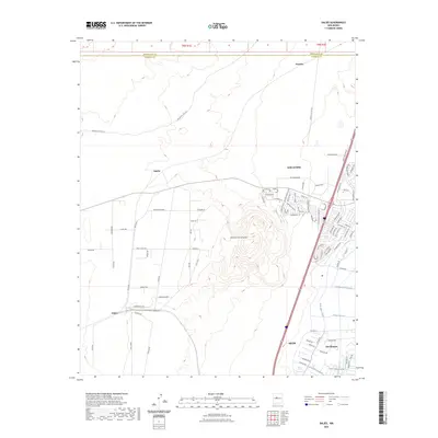
2023 Map of Dalies
USGS Topo · Published 2023About this map
El Cerro de los Lunas dominates the central landscape of this Valencia County region, serving as a prominent topographical anchor between the expanding suburban fringes of Los Lunas and the historical rail junction area of Dalies. The western portion of the map remains largely open, characterized by tribal routes like Indian Svc Rte 610 near Sandia. To the east, the modern development of Los Lunas contrasts with the intricate agricultural irrigation network further south.
Find a feature on this map
92 named features on this map. Tap any name to fly to it.
Don’t see what you’re looking for? This feature index may not catch every label — zoom into the map to look around manually.
Map Details
Editions of this 2023 Dalies Map
This is the sole edition of this map. No revisions or reprints were ever made.
Other maps of this area

1952 · Wind Mesa
USGS Topo · 1:24,000

1952 · Dalies
USGS Topo · 1:24,000

1952 · Belen
USGS Topo · 1:24,000

1952 · Belen NW
USGS Topo · 1:24,000

1952 · Rio Puerco
USGS Topo · 1:24,000

1952 · Tome
USGS Topo · 1:24,000

1952 · Los Lunas
USGS Topo · 1:24,000

1952 · Isleta
USGS Topo · 1:24,000

1952 · Dalies NW
USGS Topo · 1:24,000

1954 · Socorro
USGS Topo · 1:250,000