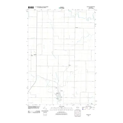
2010 Map of Dallas
USGS Topo · Published 2010About this map
Dallas serves as the primary hub of this Barron County landscape, where the Upper Pine Creek is managed at Anderson Dam. The village is surrounded by a patchwork of agricultural land and wooded creek bottoms, including the areas around Wickware and Hillsdale. This survey provides significant data for genealogical research, documenting several distinct burial grounds such as the Old Hillsdale Cemetery, New Scandinavia Cemetery, and the Sioux Creek Cemetery near the southern boundary. The presence of the Severson Number 2 Landing Strip and Pine Crest Golf Course near the town center indicates a mix of local utility and recreation. The drainage network is well-defined by the Yellow River in the northeast and the meandering paths of Brown Creek and Sioux Creek, which characterize the township's water-rich topography.
Find a feature on this map
52 named features on this map. Tap any name to fly to it.
Don’t see what you’re looking for? This feature index may not catch every label — zoom into the map to look around manually.
Map Details
Editions of this 2010 Dallas Map
This is the sole edition of this map. No revisions or reprints were ever made.
Other maps of this area

1949 · New Auburn
USGS Topo · 1:62,500

1949 · Ridgeland
USGS Topo · 1:62,500

1951 · Ridgeland
USGS Topo · 1:62,500

1951 · New Auburn
USGS Topo · 1:62,500

1951 · Chetek
USGS Topo · 1:62,500

1951 · Barron
USGS Topo · 1:62,500

1953 · Rice Lake
USGS Topo · 1:250,000

1959 · Rice Lake
USGS Topo · 1:250,000
1975 · Sand Creek
USGS Topo · 1:24,000
1975 · Ridgeland NE
USGS Topo · 1:24,000