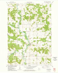
1975 Map of Sand Creek
USGS Topo · Published 1978About this map
The Red Cedar River carves a central path through this mid-1970s landscape, serving as the primary geographical anchor for the surrounding rural communities of Barron and Dunn Counties. The settlement of Sand Creek sits at a prominent bend in the river, surrounded by a high density of spiritual and commemorative sites that speak to the area's deep-rooted heritage. Local genealogy and history are well-represented by numerous burial grounds and congregations, including Dovre Ch Cem, Myron Cem, and New Hope Ch.
Find a feature on this map
42 named features on this map. Tap any name to fly to it.
Don’t see what you’re looking for? This feature index may not catch every label — zoom into the map to look around manually.
Map Details
Editions of this 1975 Sand Creek Map
This is the sole edition of this map. No revisions or reprints were ever made.
Other maps of this area

1949 · New Auburn
USGS Topo · 1:62,500

1949 · Ridgeland
USGS Topo · 1:62,500

1951 · Ridgeland
USGS Topo · 1:62,500

1951 · New Auburn
USGS Topo · 1:62,500

1951 · Chetek
USGS Topo · 1:62,500

1951 · Barron
USGS Topo · 1:62,500

1953 · Rice Lake
USGS Topo · 1:250,000

1959 · Rice Lake
USGS Topo · 1:250,000
1975 · Colfax North
USGS Topo · 1:24,000
1975 · New Auburn
USGS Topo · 1:24,000