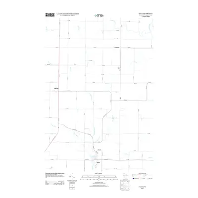
2013 Map of Dallas
USGS Topo · Published 2013About this map
Dallas serves as the primary hub of this southern Barron County landscape, situated along the Dallas Flowage 14 where the waters of Upper Pine Cr are managed. The village layout is clearly defined by its street grid, including W Dallas St and E Dallas St, transitioning into a broader agricultural region marked by dispersed settlements like Hillsdale and Wickware. This 2013 survey illustrates a rural economy intertwined with local recreation and industry, evidenced by landmarks such as the Pine Crest Golf Course and the Last Chance Dairy.
Find a feature on this map
57 named features on this map. Tap any name to fly to it.
Don’t see what you’re looking for? This feature index may not catch every label — zoom into the map to look around manually.
Map Details
Editions of this 2013 Dallas Map
This is the sole edition of this map. No revisions or reprints were ever made.
Other maps of this area

1949 · New Auburn
USGS Topo · 1:62,500

1949 · Ridgeland
USGS Topo · 1:62,500

1951 · Ridgeland
USGS Topo · 1:62,500

1951 · New Auburn
USGS Topo · 1:62,500

1951 · Chetek
USGS Topo · 1:62,500

1951 · Barron
USGS Topo · 1:62,500

1953 · Rice Lake
USGS Topo · 1:250,000

1959 · Rice Lake
USGS Topo · 1:250,000
1975 · Sand Creek
USGS Topo · 1:24,000
1975 · Ridgeland NE
USGS Topo · 1:24,000