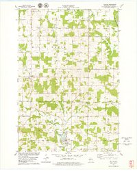
1978 Map of Dallas
USGS Topo · Published 1979About this map
The village of Dallas and the small crossroads of Hillsdale anchor this late-1970s topographic study of Barron County. The landscape is defined by the transition from active waterways like the Yellow River and Red Cedar River to the agricultural grid of Maple Grove. Historical infrastructure is evident in the Old Railroad Grade running through the western half of the map, tracing a path past the Old Hillsdale Cem. Local social and religious hubs are marked by features such as the Prairie Lake Ch and the Golf Course south of town. Notable for genealogists, several burial sites including the Dallas Cem and Sioux Creek Cem are clearly located near the banks of Sioux Creek. Small-scale aviation and industry are represented by the Severson No 2 Landing Strip and several labeled Quarry and Sandpit locations.
Find a feature on this map
33 named features on this map. Tap any name to fly to it.
Don’t see what you’re looking for? This feature index may not catch every label — zoom into the map to look around manually.
Map Details
Editions of this 1978 Dallas Map
This is the sole edition of this map. No revisions or reprints were ever made.
Other maps of this area

1949 · New Auburn
USGS Topo · 1:62,500

1949 · Ridgeland
USGS Topo · 1:62,500

1951 · Ridgeland
USGS Topo · 1:62,500

1951 · New Auburn
USGS Topo · 1:62,500

1951 · Chetek
USGS Topo · 1:62,500

1951 · Barron
USGS Topo · 1:62,500

1953 · Rice Lake
USGS Topo · 1:250,000

1959 · Rice Lake
USGS Topo · 1:250,000
1975 · Sand Creek
USGS Topo · 1:24,000
1975 · Ridgeland NE
USGS Topo · 1:24,000