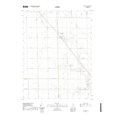
2021 Map of Dalton City
USGS Topo · Published 2021About this map
Dalton City and Bethany anchor this Central Illinois landscape, where the prairie grid is deeply etched by the corridors of the Macon, Shelby, and Moultrie county lines. The settlement pattern follows the diagonal path of Old Il Rte 121, which cuts through the township sections toward the southeast. Significant local landmarks such as Sharp Airport and the historic New Hope Cem reflect the community's mid-century infrastructure and genealogy. The terrain is defined by the winding drainages of Marrowbone Cr and Brush Cr, which break the geometric precision of the farm roads. This modern survey captures the enduring rural character of the region, providing a clear view of the cemeteries, small-town street plans like W Roney St, and the essential watercourses that have shaped local farming for generations.
Find a feature on this map
41 named features on this map. Tap any name to fly to it.
Don’t see what you’re looking for? This feature index may not catch every label — zoom into the map to look around manually.
Map Details
Editions of this 2021 Dalton City Map
This is the sole edition of this map. No revisions or reprints were ever made.
Other maps of this area

1929 · Decatur
USGS Topo · 1:62,500

1933 · Decatur
USGS Topo · 1:62,500

1935 · Sullivan
USGS Topo · 1:48,000

1940 · Sullivan
USGS Topo · 1:62,500

1949 · Dalton City
USGS Topo · 1:62,500

1955 · Bement
USGS Topo · 1:62,500

1958 · Decatur
USGS Topo · 1:250,000

1961 · Decatur
USGS Topo · 1:250,000

1967 · Long Creek
USGS Topo · 1:24,000

1967 · Decatur
USGS Topo · 1:24,000