
1967 Map of Decatur
USGS Topo · Published 1968About this map
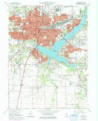
Millikin University and the downtown core of Decatur anchor this mid-century look at the Macon County seat, showing a city defined by its dense rail infrastructure and the expansive Lake Decatur. Multiple lines including the Baltimore and Ohio and Norfolk and Western railroads converge near the Illinois Central Terminal, illustrating the city's role as a major Midwestern transportation hub. The residential expansion is marked by numerous neighborhood schools like MacArthur High School and Eisenhower High School, while several large burial grounds, including Graceland Cemetery and Greenwood Cemetery, reflect the city's long-term settlement history.
Find a feature on this map
106 named features on this map. Tap any name to fly to it.
Don’t see what you’re looking for? This feature index may not catch every label — zoom into the map to look around manually.
Map Details
Editions of this 1967 Decatur Map
2 editions found
Other maps of this area

1929 · Decatur
USGS Topo · 1:62,500

1933 · Decatur
USGS Topo · 1:62,500

1949 · Dalton City
USGS Topo · 1:62,500

1952 · Assumption
USGS Topo · 1:62,500

1954 · Niantic
USGS Topo · 1:62,500

1958 · Decatur
USGS Topo · 1:250,000

1961 · Decatur
USGS Topo · 1:250,000

1967 · Long Creek
USGS Topo · 1:24,000
1967 · Argenta
USGS Topo · 1:24,000
1967 · Forsyth
USGS Topo · 1:24,000