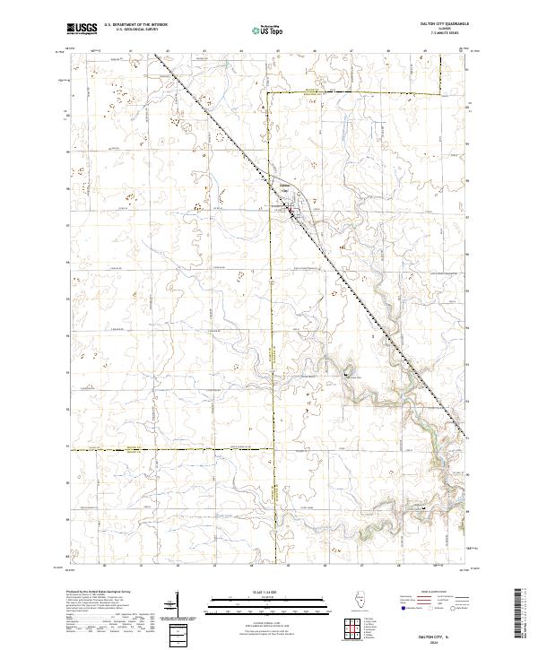
2024 Map of Dalton City
USGS Topo · Published 2024About this map
Dalton City stands at the intersection of a sprawling rural road network where the borders of Macon, Moultrie, and Shelby counties converge. This 2024 survey reveals a landscape defined by industrial agriculture, with modern section lines and township roads such as 2000 N Dora Township Rd and 2900 N Shelby Co carving through the prairie. The natural drainage of the region persists through the winding paths of Big Creek, Marrowbone Creek, and Brush Creek, which contrast with the rigid geometry of the surrounding fields. Local history is anchored by long-standing landmarks like New Hope Cem and Walker Cem, while the legacy of regional transportation is visible along Old IL Rte 121 and various county highways. The map provides a detailed view of the contemporary rural infrastructure that sustains these Central Illinois communities.
Find a feature on this map
48 named features on this map. Tap any name to fly to it.
Don’t see what you’re looking for? This feature index may not catch every label — zoom into the map to look around manually.
Map Details
Editions of this 2024 Dalton City Map
This is the sole edition of this map. No revisions or reprints were ever made.
Other maps of this area

1929 · Decatur
USGS Topo · 1:62,500

1933 · Decatur
USGS Topo · 1:62,500

1935 · Sullivan
USGS Topo · 1:48,000

1940 · Sullivan
USGS Topo · 1:62,500

1949 · Dalton City
USGS Topo · 1:62,500

1955 · Bement
USGS Topo · 1:62,500

1958 · Decatur
USGS Topo · 1:250,000

1961 · Decatur
USGS Topo · 1:250,000

1967 · Long Creek
USGS Topo · 1:24,000

1967 · Decatur
USGS Topo · 1:24,000