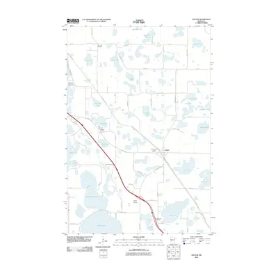
2010 Map of Dalton
USGS Topo · Published 2010About this map
Dalton serves as the primary hub of this glaciated landscape in Otter Tail County, positioned at the intersection of several significant local transit corridors. The town is flanked by the Central Lakes Trl and the Pomme de Terre River, illustrating the area's transition from early river-based geography to modern recreational use. The terrain is defined by a dense concentration of water bodies, including North Tenmile Lake, Tenmile Lake, and Rose Lake, where the Rose Lake Dam regulates local water levels.
Find a feature on this map
64 named features on this map. Tap any name to fly to it.
Don’t see what you’re looking for? This feature index may not catch every label — zoom into the map to look around manually.
Map Details
Editions of this 2010 Dalton Map
This is the sole edition of this map. No revisions or reprints were ever made.
Other maps of this area

1910 · Wendell
USGS Topo · 1:62,500

1913 · Ashby
USGS Topo · 1:62,500

1913 · Fergus Falls
USGS Topo · 1:62,500

1913 · Wendell
USGS Topo · 1:62,500

1915 · Underwood
USGS Topo · 1:62,500

1953 · Fargo
USGS Topo · 1:250,000

1953 · Brainerd
USGS Topo · 1:250,000

1956 · Fargo
USGS Topo · 1:250,000

1957 · Brainerd
USGS Topo · 1:250,000

1958 · Brainerd
USGS Topo · 1:250,000
Featured Places
- Dalton, MN
- Dane Prairie Township, MN
- Saint Olaf Township, MN
- Dalton Trailer Court, Dalton
- Tordenskjold Township, MN