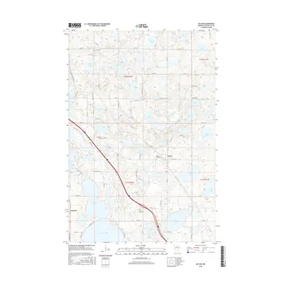
2016 Map of Dalton
USGS Topo · Published 2016About this map
Dalton serves as the central hub of this Otter Tail County landscape, where the prairie meets a dense concentration of glacial lakes. The village is flanked by significant local landmarks, including the Zion Lutheran Church Cem, reflecting the area's deep Lutheran roots. To the southwest, the Pomme de Terre River snakes through the terrain near Mud Lake, providing a natural corridor through the agricultural sections. The map reveals a high density of water bodies that shaped local life and recreation, from the expansive Tenmile Lake and N Tenmile Lake in the south to the smaller Glorvigan Lake at the northern boundary. Genealogists will find value in the clearly marked family and community burial sites, such as the Swan Lake Cem and the Sarpsborg Cem located along the river's path.
Find a feature on this map
70 named features on this map. Tap any name to fly to it.
Don’t see what you’re looking for? This feature index may not catch every label — zoom into the map to look around manually.
Map Details
Editions of this 2016 Dalton Map
This is the sole edition of this map. No revisions or reprints were ever made.
Other maps of this area

1910 · Wendell
USGS Topo · 1:62,500

1913 · Ashby
USGS Topo · 1:62,500

1913 · Fergus Falls
USGS Topo · 1:62,500

1913 · Wendell
USGS Topo · 1:62,500

1915 · Underwood
USGS Topo · 1:62,500

1953 · Fargo
USGS Topo · 1:250,000

1953 · Brainerd
USGS Topo · 1:250,000

1956 · Fargo
USGS Topo · 1:250,000

1957 · Brainerd
USGS Topo · 1:250,000

1958 · Brainerd
USGS Topo · 1:250,000
Featured Places
- Dalton, MN
- Dane Prairie Township, MN
- Saint Olaf Township, MN
- Dalton Trailer Court, Dalton
- Tordenskjold Township, MN