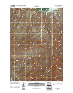
2011 Map of Daly Creek
USGS Topo · Published 2011About this map
Powder River and the northern reaches of Brownlee Reservoir define the northern boundary of this high-desert landscape in eastern Baker County. The terrain is deeply incised by drainages such as Chalk Creek and Cherry Spring Creek, which flow toward the reservoir. Human footprints on the land are sparse, concentrated around the irrigation and ranching infrastructure that makes life possible in this arid environment.
Find a feature on this map
23 named features on this map. Tap any name to fly to it.
Don’t see what you’re looking for? This feature index may not catch every label — zoom into the map to look around manually.
Map Details
Editions of this 2011 Daly Creek Map
This is the sole edition of this map. No revisions or reprints were ever made.
Other maps of this area

1915 · Pine
USGS Topo · 1:125,000

1955 · Baker
USGS Topo · 1:250,000

1957 · Halfway
USGS Topo · 1:62,500

1957 · Sparta
USGS Topo · 1:62,500

1957 · Durkee
USGS Topo · 1:62,500

1957 · Mineral
USGS Topo · 1:62,500

1959 · Baker
USGS Topo · 1:250,000

1981 · Baker
USGS Topo · 1:100,000
1987 · Richland
USGS Topo · 1:24,000
1987 · Connor Creek
USGS Topo · 1:24,000