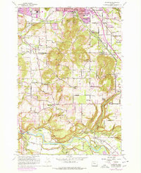
1961 Map of Damascus
USGS Topo · Published 1978About this map
The Clackamas River carves through the southern landscape of this 1961 survey, where the river-bottom communities of Carver and Barton mark historic crossings at Bakers Bridge and Barton Bridge. Further north, the agricultural and timbered upland is punctuated by the village of Damascus and landmarks like the Damascus Union Sch. The map records an era of transition as the urban footprint of Gresham begins to expand southward, yet much of the area remains defined by local industry and family-named landmarks. Features such as the Brick Factory near Hogan, the Hardscrabble Quarry, and the Portland Traction rail line illustrate the regional economy. From the historic Baker Cabin to the community centers like Rock Creek Community Hall, the map preserves a detailed view of Clackamas County's rural character before extensive suburbanization.
Find a feature on this map
83 named features on this map. Tap any name to fly to it.
Don’t see what you’re looking for? This feature index may not catch every label — zoom into the map to look around manually.
Map Details
Editions of this 1961 Damascus Map
4 editions found
Other maps of this area

1897 · Portland
USGS Topo · 1:62,500

1905 · Portland
USGS Topo · 1:62,500

1911 · Boring
USGS Topo · 1:48,000

1914 · Boring
USGS Topo · 1:62,500

1914 · Oregon City
USGS Topo · 1:62,500

1916 · Estacada
USGS Topo · 1:125,000

1918 · Troutdale
USGS Topo · 1:62,500

1934 · Troutdale
USGS Topo · 1:48,000

1939 · Oregon City
USGS Topo · 1:62,500

1940 · Boring
USGS Topo · 1:62,500