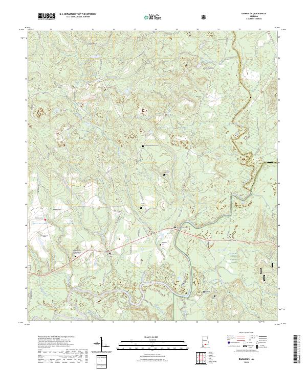
2024 Map of Damascus
USGS Topo · Published 2024About this map
The settlement of Damascus serves as the focal point for this southern Alabama landscape, situated near the confluence of several significant waterways. The area is defined by the winding paths of the Conecuh River and Sepulga River, which dictate the local topography and historical transportation routes. Land use in this region reflects a blend of private holdings and public lands within the Conecuh National Forest, where smaller tributaries like Grab Mill Creek and Hell Hole Creek drain into the primary river system.
Find a feature on this map
59 named features on this map. Tap any name to fly to it.
Don’t see what you’re looking for? This feature index may not catch every label — zoom into the map to look around manually.
Map Details
Editions of this 2024 Damascus Map
This is the sole edition of this map. No revisions or reprints were ever made.
Other maps of this area

1953 · Andalusia
USGS Topo · 1:250,000

1957 · Andalusia
USGS Topo · 1:250,000

1971 · Dixie
USGS Topo · 1:24,000

1971 · Bradley
USGS Topo · 1:24,000

1971 · Loango
USGS Topo · 1:24,000

1982 · Shipps Creek
USGS Topo · 1:24,000
1982 · Roberts
USGS Topo · 1:24,000

1982 · Damascus
USGS Topo · 1:24,000

1982 · Nymph
USGS Topo · 1:24,000
1982 · Brooklyn
USGS Topo · 1:24,000