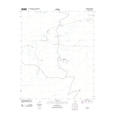
2012 Map of Damon
USGS Topo · Published 2012About this map
Veterans Colony and the rural community of Damon anchor this portion of Latimer County, situated within a landscape defined by the branching tributaries of the Gaines Creek system. The map reflects a modern rural infrastructure of county roads and residential loops, such as Circle Dr E and Huston Cir, which contrast with the older landmarks of the area. Genealogists and local researchers will find the Damon Cem located off Damon Valley Rd, a central point for those tracing families from this part of Oklahoma.
Find a feature on this map
40 named features on this map. Tap any name to fly to it.
Don’t see what you’re looking for? This feature index may not catch every label — zoom into the map to look around manually.
Map Details
Editions of this 2012 Damon Map
This is the sole edition of this map. No revisions or reprints were ever made.
Other maps of this area

1901 · Tuskahoma
USGS Topo · 1:125,000

1908 · Tuskahoma
USGS Topo · 1:125,000

1909 · Tuskahoma
USGS Topo · 1:125,000

1940 · Red Oak
USGS Topo · 1:62,500

1943 · Red Oak
USGS Topo · 1:62,500

1950 · Mcalester
USGS Topo · 1:250,000

1962 · McAlester
USGS Topo · 1:250,000

1965 · McAlester
USGS Topo · 1:250,000

1971 · Yanush
USGS Topo · 1:24,000

1971 · Kiamichi
USGS Topo · 1:24,000