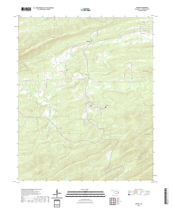
2022 Map of Damon
USGS Topo · Published 2022About this map
Damon serves as the focal point of this section of Latimer County, situated in a valley between significant elevations. The landscape is defined by its dramatic relief, notably Blue Mtn to the northwest and Eightmile Mtn to the southeast, with Bobcat Ridge rising in the northeast. Waterways such as Gaines Cr and its tributaries, N Gaines Cr and S Gaines Cr, drain the central valleys, while Pine Cr and Anderson Cr flow through the southern reaches. The map highlights key local landmarks including Damon Cem and the Veterans Colony Cem near the intersection of Metcalf and Edgewood. A network of rural routes like Damon Valley Rd and Hulsey Prairie Rd connect the scattered homesteads across this varied topography.
Find a feature on this map
54 named features on this map. Tap any name to fly to it.
Don’t see what you’re looking for? This feature index may not catch every label — zoom into the map to look around manually.
Map Details
Editions of this 2022 Damon Map
This is the sole edition of this map. No revisions or reprints were ever made.
Other maps of this area

1901 · Tuskahoma
USGS Topo · 1:125,000

1908 · Tuskahoma
USGS Topo · 1:125,000

1909 · Tuskahoma
USGS Topo · 1:125,000

1940 · Red Oak
USGS Topo · 1:62,500

1943 · Red Oak
USGS Topo · 1:62,500

1950 · Mcalester
USGS Topo · 1:250,000

1962 · McAlester
USGS Topo · 1:250,000

1965 · McAlester
USGS Topo · 1:250,000

1971 · Yanush
USGS Topo · 1:24,000

1971 · Kiamichi
USGS Topo · 1:24,000