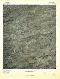
1977 Map of Damon
USGS Topo · Published 1977About this map
Damon sits at the northern edge of this Latimer County landscape, captured in a 1977 orthophotoquad that reveals the intersection of terrain and water. The area is defined by the prominent ridge of Blue Mountain to the north and the high ground of Eightmile Mountain in the southeast. This aerial perspective shows the natural drainage patterns of the region, where North Gaines Creek and South Gaines Creek converge to form the primary Gaines Creek corridor. Unlike traditional line-drawn maps, this photo-based record emphasizes the density of forest cover and the scattered agricultural clearings that represent the rural character of southeastern Oklahoma during the late 1970s. It provides a literal view of the winding roads and property boundaries as they existed during this specific spring season.
Find a feature on this map
6 named features on this map. Tap any name to fly to it.
Don’t see what you’re looking for? This feature index may not catch every label — zoom into the map to look around manually.
Map Details
Editions of this 1977 Damon Map
This is the sole edition of this map. No revisions or reprints were ever made.
Other maps of this area

1901 · Tuskahoma
USGS Topo · 1:125,000

1908 · Tuskahoma
USGS Topo · 1:125,000

1909 · Tuskahoma
USGS Topo · 1:125,000

1940 · Red Oak
USGS Topo · 1:62,500

1943 · Red Oak
USGS Topo · 1:62,500

1950 · Mcalester
USGS Topo · 1:250,000

1962 · McAlester
USGS Topo · 1:250,000

1965 · McAlester
USGS Topo · 1:250,000

1971 · Yanush
USGS Topo · 1:24,000

1971 · Kiamichi
USGS Topo · 1:24,000