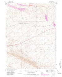
1971 Map of Dana
USGS Topo · Published 1983About this map
The Union Pacific railroad corridor defines this high-desert landscape in Carbon County, where the historic tracks follow the winding course of Saint Marys Creek. Heavy industrial footprints are prominent throughout the area, including the substantial Strip Mine operations and the Big Ditch Pit. These extraction sites are served by specialized rail infrastructure such as the Arch Mineral Corp Railroad (Dana Spur) and the Energy Development Co Spur, highlighting the coal-driven economy of the early 1970s.
Find a feature on this map
22 named features on this map. Tap any name to fly to it.
Don’t see what you’re looking for? This feature index may not catch every label — zoom into the map to look around manually.
Map Details
Editions of this 1971 Dana Map
2 editions found
Other maps of this area

1893 · Fort Steele
USGS Topo · 1:125,000

1914 · Hanna
USGS Topo · 1:62,500

1914 · Walcott
USGS Topo · 1:62,500

1954 · Rawlins
USGS Topo · 1:250,000

1955 · Coal Bank Basin
USGS Topo · 1:24,000

1955 · Meads
USGS Topo · 1:24,000

1955 · Rattlesnake Pass
USGS Topo · 1:24,000

1958 · Rawlins
USGS Topo · 1:250,000

1962 · Rawlins
USGS Topo · 1:250,000

1967 · Rawlins
USGS Topo · 1:250,000