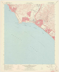
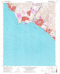
1968 Map of Dana Point
USGS Topo · Published 1970About this map
San Juan Capistrano serves as a focal point for this late 1960s coastal survey, where the historic community meets the developing corridor along the Atchison Topeka and Santa Fe railroad. The coastline is defined by the significant infrastructure of Dana Point Harbor and the protected waters of Dana Cove, transitioning into the residential and recreational landscapes of Capistrano Beach and San Clemente. This era captures a region in transition, balancing established landmarks like the San Juan Hills Country Club with new educational and medical facilities, including the Forster Jr HS and local hospital. Along the shore, Doheny State Beach and Three Arch Bay provide a detailed look at the maritime geography from Mussel Cove down to Poche, during a period of rapid suburban growth in southern Orange County.
Find a feature on this map
50 named features on this map. Tap any name to fly to it.
Don’t see what you’re looking for? This feature index may not catch every label — zoom into the map to look around manually.
Map Details
Editions of this 1968 Dana Point Map
5 editions found
Other maps of this area

1896 · Santa Ana
USGS Topo · 1:62,500

1901 · Southern California Sheet No. 1
USGS Topo · 1:250,000

1901 · Santa Ana
USGS Topo · 1:62,500

1902 · Capistrano
USGS Topo · 1:125,000

1902 · Corona
USGS Topo · 1:125,000

1904 · Southern California Sheet No. 2
USGS Topo · 1:250,000

1904 · Southern California Sheet No. 1
USGS Topo · 1:250,000

1906 · Capistrano
USGS Topo · 1:125,000

1942 · San Juan Capistrano
USGS Topo · 1:62,500
1942 · Santa Ana
USGS Topo · 1:62,500