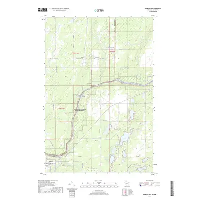
2019 Map of Danbury East
USGS Topo · Published 2019About this map
The Saint Croix River forms a jagged natural boundary between Pine County, Minnesota, and Burnett County, Wisconsin, anchoring this landscape of water and forest. To the north, the small settlement of Markville sits near the Markville Cem, where local roads like N Markville Rd and S Markville Rd branch out through the timberlands. Much of the river corridor is protected as part of the Saint Croix National Scenic Riverway and the St. Croix Wild and Scenic River, preserving the riparian environment where Trout Brook and Crystal Cr join the main flow.
Find a feature on this map
68 named features on this map. Tap any name to fly to it.
Don’t see what you’re looking for? This feature index may not catch every label — zoom into the map to look around manually.
Map Details
Editions of this 2019 Danbury East Map
This is the sole edition of this map. No revisions or reprints were ever made.
Other maps of this area

1949 · Danbury
USGS Topo · 1:48,000

1949 · Hertel
USGS Topo · 1:48,000

1949 · Webb Lake
USGS Topo · 1:48,000

1950 · Webster
USGS Topo · 1:48,000

1953 · Duluth
USGS Topo · 1:250,000

1953 · Stillwater
USGS Topo · 1:250,000

1955 · Hertel
USGS Topo · 1:62,500

1955 · Webb Lake
USGS Topo · 1:62,500

1955 · Webster
USGS Topo · 1:62,500

1955 · Stillwater
USGS Topo · 1:250,000