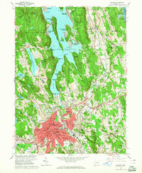
1963 Map of Danbury
USGS Topo · Published 1965About this map
Danbury serves as the industrial and civic anchor of this Fairfield County landscape during the early 1960s, a period marked by significant postwar suburban expansion around its historic core. The city is dense with institutional landmarks, from the Danbury Hospital and State College to the sprawling Danbury Fairgrounds and Danbury Municipal Airport. Beyond the urban center, the geography is defined by the massive footprint of Lake Candlewood, whose jagged shoreline is lined with residential developments like Candlewood Isle and Candlewood Shores.
Find a feature on this map
150 named features on this map. Tap any name to fly to it.
Don’t see what you’re looking for? This feature index may not catch every label — zoom into the map to look around manually.
Map Details
Editions of this 1963 Danbury Map
4 editions found
Other maps of this area

1892 · Danbury
USGS Topo · 1:62,500

1892 · New Milford
USGS Topo · 1:62,500

1892 · Carmel
USGS Topo · 1:62,500

1893 · Carmel
USGS Topo · 1:62,500

1893 · New Milford
USGS Topo · 1:62,500

1893 · Clove
USGS Topo · 1:62,500

1894 · Clove
USGS Topo · 1:62,500

1894 · Carmel
USGS Topo · 1:62,500

1898 · Clove
USGS Topo · 1:62,500

1901 · Clove
USGS Topo · 1:62,500