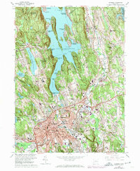
1963 Map of Danbury
USGS Topo · Published 1974About this map
Lake Candlewood dominates the northern reaches of this Fairfield County landscape, where various mid-century developments like Candlewood Shores and Candlewood Isle line the intricate shoreline. The city of Danbury serves as the primary hub to the south, showing a dense concentration of civic life ranging from State College and Danbury High Sch to the Federal Correctional Institution. The transportation network is defined by the Penn Central rail line and a series of reservoirs like Margerie Lake Reservoir and East Lake Reservoir that provide a counterpoint to the suburban expansion.
Find a feature on this map
106 named features on this map. Tap any name to fly to it.
Don’t see what you’re looking for? This feature index may not catch every label — zoom into the map to look around manually.
Map Details
Editions of this 1963 Danbury Map
4 editions found
Other maps of this area

1892 · Danbury
USGS Topo · 1:62,500

1892 · New Milford
USGS Topo · 1:62,500

1892 · Carmel
USGS Topo · 1:62,500

1893 · Carmel
USGS Topo · 1:62,500

1893 · New Milford
USGS Topo · 1:62,500

1893 · Clove
USGS Topo · 1:62,500

1894 · Clove
USGS Topo · 1:62,500

1894 · Carmel
USGS Topo · 1:62,500

1898 · Clove
USGS Topo · 1:62,500

1901 · Clove
USGS Topo · 1:62,500